7th Graders’ Beach Grass Project At Causeway Beach

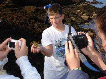
Martha Bell, Island Heritage Trust Environmental Educator, along with Mickie Flores, DISES Middle School Science teacher, and a handful of her 7th graders continue the work of studying and encouraging the strong growth of Causeway Beach’s Beach Grass this May. After having placed the flags up around the strip of grass last fall, the protected beach grass has shown great progress as it grew out beyond the flags!

BATS Need Your Help

WHAT IS HAPPENING TO BATS ON MOUNT DESERT ISLAND?

Story by Bruce Connery
Fall/Winter 2013 Friends of Acadia Journal

Rowan Wakefield Award

Long time IHT supporters Ken and Marnie Crowell were honored with the 2009 Rowan Wakefield Award at the Annual Meeting on July 8, 2009. Named for one of IHT’s most active and best-loved early presidents, the Rowan Wakefield Award is given “… to the individual, selected by the Trustees of the Island Heritage Trust, whose outstanding work has exemplified the mission of the Island Heritage Trust to conserve significant open space, scenic areas, wildlife habitats, natural resources, and historic and cultural features that offer public benefit and are essential to the character of the Deer Isle area.”

Ancient Materials Come to Light in Scott’s Landing Archaeological Dig

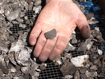
Holding artifacts that not seen the light of day for over 2,000 years, a group of amateur and professional archaeologists unearthed ancient materials from a shell midden illustrating life in the Early Archaic and Ceramic periods of Deer Isle’s paleo-Indian ancestors at Scott’s Landing this summer.

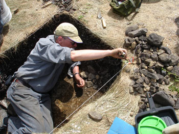
Blessed with good weather, over 20 amateur archaeologists and islanders dug and meticulously screened a small patch of the island’s newest preserve in late June and early July. After a lecture and welcoming meal at Ann and Roger Hooke’s the night before, Cox led his own archaeological team and the community participants through an enthralling but exhausting sun- up to sun-down field school on the shores of Eggemoggin Reach.

Cox’s team has worked with him on many other digs so they were paired up with community members to learn proper archaeological field techniques and how to recognize materials such as stone tools, pottery, food remains, and cultural features such as hearths and tent floors. Cox and others taught the more inexperienced participants how to record and interpret results and protect fragile artifacts for future study.

Scott's Landing Archaeological Dig

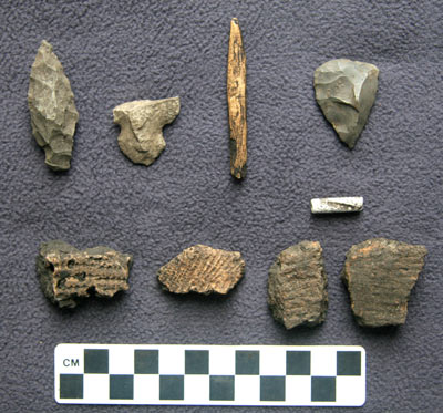
From the photo of the materials, one can see how crucial it is when excavating a site that everything be carefully removed from a site and its location recorded with precision.

Many community members remarked on the effort expended and time needed to protect the detailed history and important information that is available in a professionally supervised dig.

Scott's Landing Archaeological Dig

IHT President and anthropologist Bill Haviland says in his book, Deer Isle’s Original People, that “Once taken out of context, objects by themselves tell us next to nothing. Thus to dig around in archaeological sites looking for relics destroys them and the information they contain as effectively as if they were bulldozed into oblivion.”

He goes to say that Paleo-indian sites are generally “very small briefly but repeatedly by small groups of people – perhaps 1 or 2 families together.”
Often the sites were used for seasonal camping, fishing and harvesting for a highly mobile people who worked closely in clans and small units.
Steve Cox will be providing an in-depth public lecture about the findings of the Scotts Landing sometime in the fall of 2007.

Many thanks to Ken and Marnie Reed Crowell for their key role in creating this great opportunity for Deer Isle and the IHT and to the Bar Harbor Bank and Trust and the Island Education Foundation and other donors who underwrote the cost of the field school.

Scott's Landing Archaeological Dig

Dr. Steve Cox has over three decades of field school experience and has led excavations for the Maine State Museum and the Abbe Museum. He is currently an Adjunct Curator for the Maine State Museum.

Cox’s team included Betsy Webster, Diane Kopec, Donna Madonna, Jacob Freedman, Laurie Labar, Robert and Sandy Lewis, Robin Marion, Stephanie Wagner, and Susan Blaisdell.

Community members were 18 year-old islanders Greta Avis and Brittany Pottle, Joanie Banks, teachers Pam Cohen and Stephanie Lee, Tom and Marilyn Mehalic, Cathy Hart, Wilson Museum Director Patty Hutchins, Ken Schweikert, and Marion Foss.

Appreciation of Lloyd Capen, one of IHT’s founders

The Island lost one of its treasures March 23, 2008 with the passing of Lloyd Capen. Not long ago in an interview about his part in forming Island Heritage Trust, Lloyd recalled signing the IHT incorporation papers in April of 1987 with Jean Welch, Dud Hendrick and Cherie Mason. Lloyd described how Ruth Small Harris developed a data base for IHT with Rowan Wakefield, and they then turned around and shared that for the Medical Center and Memorial Ambulance Corps. Lloyd will also be remembered for his part in founding the Island Nursing Home. Talk about a star on a dream team!

Lloyd credited everyone who has settled here and worked for the preservation of natural areas, recognizing that our heritage is also natural. “There is no prettier seaport than Stonington,” he said. “Our beautiful islands are essentially a welcome to people to come and spend whatever time they can to enjoy the land and the people. It is the community we have created here together that is our heritage. I always feel a thrill when I come over the Causeway and see folks enjoying the beach and the bar where I used to clam as a kid.”

When praised for his book, his career, his High Meadow orchard, and his civic contributions, he modestly replied, “We just did what was expected of us in our time.” Reminiscing about life’s true satisfactions Lloyd added, “I counted it a great honor to play second base for the Stonington baseball team. Being a Deer Isle boy, that meant I was accepted as being a good person.”

A good person indeed, Lloyd, with his genial nature exemplifying the best of working together for the good of the whole Island. Lloyd Capen is a citizen who will be greatly missed.

–Island AdVantages

Salamander Big Night

What’s black with yellow spots and looks like a dinosaur? A spotted salamander, Ambystoma maculatum, of course. And on the first warm rainy night of spring, usually in early April here, you can see them in hundreds crossing the roads of the Island. It’s a wildlife spectacular of sorts.

At six to nine inches long, these gentle animals—actually amphibians, not reptiles— look something like a cigar or pencil when you spot them in your flashlight beam or car headlights. The stretch of Oceanville Road just before you get to the Settlement Quarry is perhaps Deer Isle’s premier spot for salamander watching, but any place where you can see an alder swamp from the highway is a likely spot.

The salamanders don’t make any noise. They don’t bite. Males and females look alike, at least to us. Except for the breeding period in spring when they gather to mate, we rarely see them. They lead their lives of quiet seclusion in the forest litter layer. It was discovered that the biomass of our most common salamander, the red-backed salamander, was equal to the biomass of all songbirds in a New Hampshire forest study. We may be unaware of salamanders in our midst, but you can be certain they play a significant part in the forest ecosystem.

The term vernal pool has been given increasing media attention lately. What’s a vernal pool? Strictly speaking, it’s a body of fresh water large enough for salamanders to lay their eggs in, but small enough that the pool will dry up before summer’s end. That means would-be predators like bullfrog tadpoles, which take two years to mature, cannot colonize the pool. Here on the Island we seem to have avoided bullfrog invasions, so any small pool of water will do for our salamanders.

After dark, take your flashlight and peer into such a pool and you will likely see it writhing with salamanders on their Big Night. Such a salamander Rave is called a congress. Next morning you will see globs of round eggs the size of bb shot attached to twigs in the water. Over the next weeks, tiny gilled salamanders will develop in the eggs. By summer’s end, they will have hatched, grown mature enough to have those feathery external gills reabsorbed, and off they go into the forest to burrow down into the rotting leaf layer.

You might even be fortunate enough to have a vernal pool in your own backyard. Some of our preserves have no vernal pools. Where IHT has been given adjoining conservation easements that do have such pools, you can be fairly confident that unseen, unheard, beneath your feet, the surrounding forest is well-supplied with salamanders.

Settlement Quarry April excerpt ‘Beads and String’

~Beads & String~
A Maine Island Pilgrimage
by Marnie Reed Crowell and Ann Flewelling

“Join natural history writer Marnie Reed Crowell and photographer Ann Flewelling as they take you through a year, month by month, visiting some gems of conserved lands encircling Deer Isle. It is a pilgrimage you’ll want to join as they introduce you to special places and special people. Marnie’s lively essays and poems and Ann’s luminous photographs show off land trust work at its best”
Ciona Ulbrich, Maine Coast Heritage Trust

Beads & String – Chapter II ~ April ~ Settlement Quarry

How Campbell’s Cove Became Gray’s Cove

By Bill Haviland, IHT Trustee.

One of the Island Heritage Trust’s more popular preserves is the Reach Beach at Gray’s Cove. But Gray’s Cove wasn’t always called that; originally it was Campbell’s Cove and the land to the south, now Oak Point, was called Campbell’s Neck.

The original name comes from John Campbell (1730-1820), a native of Arglyshire in Scotland who came to Deer Isle around 1780 and settled on the Reach. He was not the first to do so for as early as 1753, just before the start of the last of the French and Indian wars, William Greenlaw (also from Scotland) with his family moved onto 500 acres that stretched between what later would be called Torrey’s Mill Pond and Campbell’s Neck. Because the Greenlaws had Tory sympathies during the American Revolution, they found it expedient to flee to New Brunswick in Canada after the war. Not until some years later did some of William’s descendants return to the island, and then to Oceanville.

John Campbell acquired some of the Greenlaw lands and then some; large for the time, his holdings took in Campbell Island (on which IHT has an easement) all of what is now called Oak Point, and the lands north to beyond the junction of the Fish Creek and Reach roads, and west nearly to the junction of Fish Creek and Greenlaw District Roads.

In all, this amounted to something on the order of 460 acres. His homestead stood until nearly the end of the 20th Century at Poplar Point at the end of a private road now called Alberta Lane. By then, it had fallen into such disrepair that the Deer demolished it and the Deer Isle Fire Department used it as a means of practicing firefighting.

Campbells continued to occupy the old homestead well into the twentieth century, the last being John’s great grandson, Arthur. He is listed in the 1910 census as a farmer and lobster buyer. Arthur’s mother, Diana Campbell Hardy Campbell, was herself a granddaughter of John Campbell’s daughter Sarah. Diana’s husband, quite a bit older than she, was the son of her father’s mother’s brother. After Arthur’s death in 1951, what was left of the Campbell holdings, including the old homestead, passed to the Hutchinson descendants of Diana’s daughter May, who was fathered by her mother’s second husband, George Hatch (Hutchinson was May’s married name). Thus, the place continued to be occupied by John Campbell’s descendants until recently.

John Campbell’s daughter Sarah married Peter Hardy, Jr. (1770-1863), a master mariner who, over the course of his life, served several times as selectman and two terms in the state legislature. Although he already had a 100-acre farm – the fourth one north of Campbell’s – John deeded to his new son-in-law a 100-acre parcel running from the northwest shore of Campbell’s Cove westward along the north shore of Fish Creek. Peter and Sarah never lived there, however. Instead, they traded this parcel for the farm of Benjamin Weed (on the south end of Little Deer ) from Weed’s Point (east to the end of Weed Point Rd.). Peter and Sarah’s homestead stood where the McWilliams house now stands.

Eventually, Josiah Gray of Brooksville, who had married a daughter of Benjamin Weed, acquired the farm that his father-in-law had gotten from Peter Hardy. Together, the Grays raised thirteen children, one of whom married Silas Hardy Gray. He was the

son of Isaac Gray who settled on Little Deer Isle some time after 1800. Among Isaac’s neighbors were Peter Hardy and Jonathan Hardy, whose farm was where the bridge now lands on Little Deer. Both Jonathan and Peter had sons named Silas so obviously a close time must have existed between these Hardys and Grays.

After Josiah’s death, Silas lived in his father-in-law’s homestead until his own death in 1882. The house still stands not far from the cove; it is the first one on right-hand side of Oak Point Rd., south of the intersection of Fish Creek Rd. Either Silas’ wife’s mother and father are said to be buried behind the house. With Josiah and then Silas in residence there, the cove lost the original name and became Gray’s Cove as we know it today.

Scott’s Landing Preserve Officially Open

A large crowd turned out for the Scott’s Landing Grand Opening August 5 three years after the campaign began to purchase one of the last unspoiled shore land parcels on Deer Isle. Ciona Ulbrich of Maine Coast Heritage Trust and IHT President Bill Haviland untied the symbolic ribbon with over 50 people in attendance including young and old, new and long-time islanders. The 22-acre parcel was sold by Nathan and Ellen Pitts to the MCHT in early 2006 after a collaborative campaign between the two organizations. MCHT then deeded the property to IHT. In anticipation of long term stewardship costs, MCHT, the statewide land conservation organization, sold a two-acre parcel to fund endowment and ongoing stewardship costs. Teamed up with the four-acre parcel purchased separately by IHT in 2004, the Preserve now encompasses 24 acres of shoreline, beaches, nature trails, historic sites, and wildlife habitat.

IHT published a Scott’s Landing brochure and a Scott’s Landing History brochure that are available at the brand-new kiosk at the Preserve entrance opposite Causeway Beach. The kiosk was designed by Don Reiman and constructed by Ann and Roger Hooke, Joe Dorr, Jim White, Steve Whitney, and Steve Rowan.

Hundreds of donors and supporters contributed almost a million dollars to purchase the land with an anonymous donor closing the gap at the last minute through MCHT to complete the sale.

The Preserve is open to the public during day time hours for picnicking, trail hiking, and swimming. There are unusual plants that are listed on the back of the kiosk. Sandy and rocky beaches offer visitors a chance to explore the shore. The trails are marked with signs showing the location of the original ferry boat buildings and the Scott family barn and other historic features.

There was an archaeological dig in June directed by archaeologist Steve Cox with a team of amateur archaeologists and community members who signed up to participate in the five day dig. He and IHT President and anthropologist Bill Haviland will present a Talk on the findings in the fall. Check the web site and newspapers for date and time.

Scott's Landing Field Trip