CHURCH LAND PRESERVE, DEER ISLE
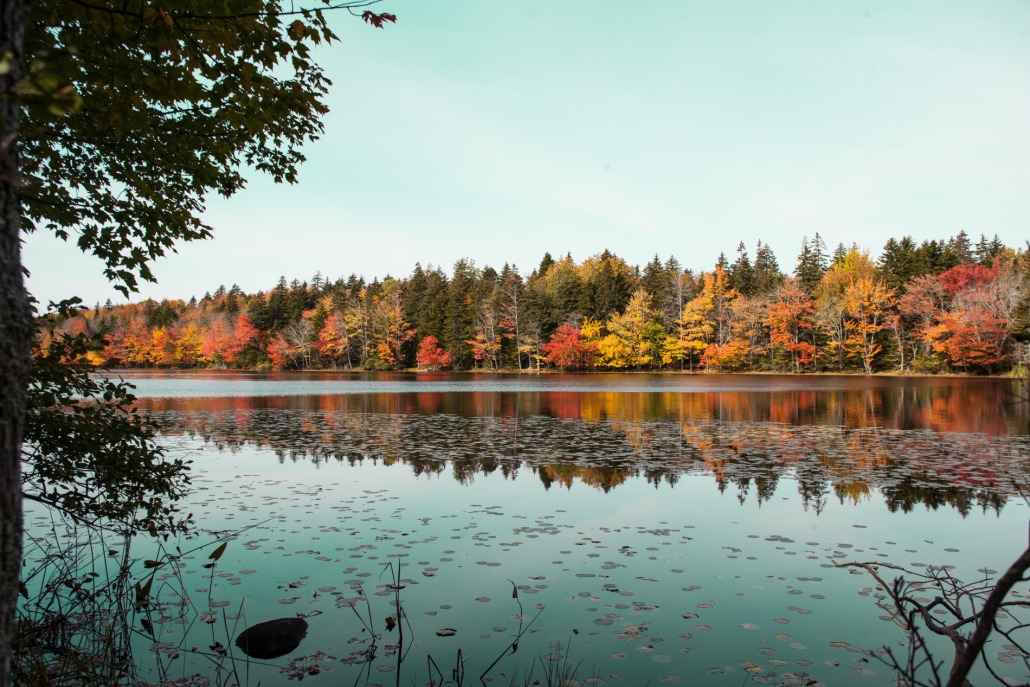
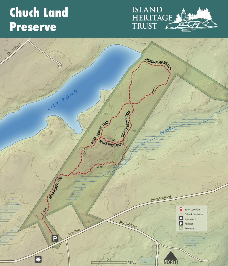
2.5 miles of mossy trails through a mature spruce-fir forest. Views of varied topography with bedrock ridges and defiles; trails to NE shore of Lily Pond.
ACTIVITIES TO ENJOY AT CHURCH LAND:
- Hiking
- Photography
- Moss & Lichen Observation
- Views of Lily Pond & a Beaver Lodge
- Trail running
- Snow shoeing
- Fishing and Hunting
2.5 MILE TRAIL SYSTEM
Traditional Rating: MODERATE
Accessibility Rating: HARD
EXPLORE THE PRESERVE
Meander along flowing trails through rich and colorful moss and lichen-covered rocks. This preserve is unique as it allows for exploration of the North end of Lily Pond where the shorelines are protected by a classic example of Deer Isle spruce-fir forest. Trail options are plentiful, with a choice to walk along a wetland that becomes the headwater to Fish Creek, over a moss-covered ridge, or between mature trees.
PLEASE FOLLOW THESE GUIDELINES:
- Day Use Only – no camping or overnight parking.
- Pets allowed under voice control.
- No fires allowed.
- Foot traffic only.
- Leave it better than you found it.
- Respect the privacy of our neighbors.
- Hunting is permitted – please contact Island Heritage Trust for permission and approval
DIRECTIONS TO THE PRESERVE
From the Deer Isle Causeway, drive South on Route 15 for approximately 4 miles. Shortly past Deer Isle Village, turn left onto King Row. Less than a mile down King Row, the Church Land Preserve parking lot will be on your left, across from the cemetery.
GET TO KNOW THE FLORA & FAUNA
With Ecologist, Dr. Ken Crowell, & Naturalist, Marnie Reed Crowell:
Each boulder along the way is a new lesson in moss and fern and lichen appreciation if not identification. On some tree trunks you may see the round grey-green circles of what has been jokingly called 40 mile an hour lichen.
The moss which carpets the forest floor is also quite easy to identify. It is most likely called Schreber’s or Red Feather moss. Schreber was a contemporary of Linnaeus and sent him specimens. The moss is also called Red Feather because you can see a red central line if you look closely.
On either side of the trail you can reach out and touch flat firs or feel the sharp spines of red spruce.
Check Out the FULL Virtual Guided Walk through Church Land Preserve
STORY OF PUBLIC ACCESS
In 2016, this 30-acre parcel was purchased by a supporter of IHT and donated to the trust at the end of 2017. With the protection of Lily Pond in mind, this supporter was particularly interested in Lily Pond’s highly valued wooded shoreline, and its importance to the people of Deer Isle. This project ensured public access in perpetuity and further protected the Lily Pond itself from future development along part of its surrounding watershed.
HISTORY OF CHURCH LAND PRESERVE:
This land was part of a 400-acre parcel given to the Settlers of Deer Isle by the Commonwealth of Massachusetts in 1797 for use of the ministry. The transfer took place only 8 years after the Town of Deer Isle was incorporated in 1789. It remained under the management of the Deer Isle Church from 1797 to 2016. This land was considered “Glebe Land,” as its purpose was to support parish ministers. This term and practice dates to medieval times in Britain as ministers needed land for their livestock, gardens, and woodlots.
Much of the original 400 acres is still owned by the church and serves as the location of the Mount Adams Cemetery located on the south side of King Row where many well-known past residents of the island are interred. Presumably, IHT’s part of the original tract was used historically as a wood lot. There are remnants of woods roads, but no other remnants of structures remain on the land.


